


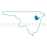
Voting District CONWAY, Northampton County, North Carolina
About
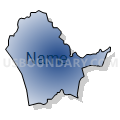
Outline

Summary
| Unique Area Identifier | 641021 |
| Name | Voting District CONWAY |
| County | Northampton County |
| State | North Carolina |
| Area (square miles) | 14.03 |
| Land Area (square miles) | 13.96 |
| Water Area (square miles) | 0.07 |
| % of Land Area | 99.53 |
| % of Water Area | 0.47 |
| Latitude of the Internal Point | 36.44509450 |
| Longtitude of the Internal Point | -77.23133260 |
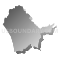
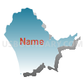
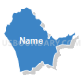
Maps


Graphs
Select a template below for downloading or customizing gragh for Voting District CONWAY, Northampton County, North Carolina


Neighbors
Neighoring Voting District (by Name) Neighboring Voting District on the Map
- Voting District CREEKS, Northampton County, NC
- Voting District GALATI, Northampton County, NC
- Voting District MILWAU, Northampton County, NC
- Voting District NEWTOW, Northampton County, NC
- Voting District PENDLE, Northampton County, NC